
Gov’t using Geographic Information Systems (G.I.S.) to expand the country’s irrigation programme
 30 September 2026

Gov’t using Geographic Information Systems (G.I.S.) to expand the country’s irrigation programme – IRIE FM
September 30, 2026
Written bySugar Ray Thomas
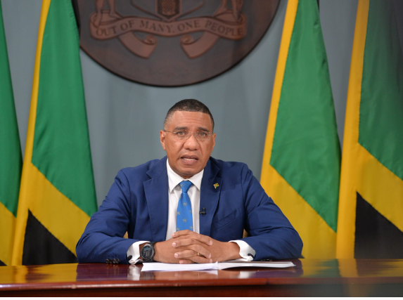
The Government is using Geographic Information Systems (G.I.S.) to expand the country’s irrigation programme.
This is aimed at ensuring that local farmers gain access to reliable water sources to boost agricultural production.
Prime Minister Dr. Andrew Holness made the announcement at the Spatial Arc G.I.S. Conference at the A.C. Hotel this morning.
G.I.S. is a computer system that captures, stores, analyzes and displays data linked to specific locations on Earth’s surface.
The Government has been using G.I.S. technology to support data-driven decision-making and the development of an integrated national geo-spatial infrastructure.
Dr. Holness says the technology is assisting in the development of the Pedro Plains Irrigation Project in St Elizabeth.
He added that G.I.S. is being used to gain a better understanding of how persons utilize water on their farmlands.
https://iriefm.net/wp-content/uploads/2026/09/HOLNESS-GIS-FARMING.mp3
Trending News

Related News
Education Ministry establishes Hurricane Melissa School Infrastructure Recovery and Resili...
Work on Montego Bay Perimeter Road Project paused, as contractor reviews safety procedures
PM Holness says Gov’t looking to secure additional funding to support road and infrastru...